Android • iOS • Web
Dodanati is a simple dark map that highlights speed bumps and road holes, so you can plan smoother trips. Mark what you see, preview your route, and estimate how many bumps and holes are waiting ahead.
Free to use. Anonymous by default. Just open the map and see the road reality.
Every marker is a speed bump or road hole shared by drivers like you. Zoom in, move the map, and explore the road surface in seconds.
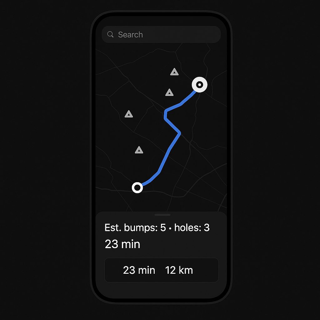
Choose a destination and see how many bumps and holes are expected along the way, so you can decide which route is worth it.
Adding a bump or hole is one tap. No complicated UI, just dark map, white markers, and honest road info from the people who drive it.
Allow location or search by city. Start with your daily routes, work commute, or favorite shortcuts.
Tap once to add a speed bump. Tap again for a hole. Keep it simple, accurate, and useful for everyone.
Choose a destination, review the bump & hole count, and take the route that fits your car, your time, and your patience.
Dodanati only works if drivers contribute. Add the bumps you cross, the holes you avoid, and update segments as roads change.
Dodanati is starting with Algeria and grows where drivers contribute data. Even if your city is empty now, you can be the first to map it.
Basic browsing and previewing routes are available without sign-up. Creating an account unlocks history, favorites, and more advanced tools.
Counts are based on community markers along your route. Roads change, so we encourage drivers to update segments when bumps are removed or new holes appear.
No. It’s useful for cars, motorcycles, delivery scooters, and even cyclists—anyone who cares about the quality of the road.